The project aims to integrate geospatial and Earth observation technologies into teaching and learning through project-based laboratory exercises, a new course on Applications of Drone and Data Technologies and expanded experiential learning opportunities.
The initiative supports UMP's objective of broadening academic programme delivery while strengthening graduate attributes such as critical thinking, adaptability and innovation. It also builds capacity in disciplines aligned with the University's niche areas, including environmental sustainability, conservation and spatial sciences.
Fulbright Specialist Professor Suresh Muthukrishnan, Director of the GIS and Remote Sensing Centre at Furman University, said geospatial technologies, drones and artificial intelligence (AI) are becoming increasingly important in environmental science education.
"A student with a drone, an internet connection, and open-source GIS software can now conduct analysis that would have required a large research team and significant funding twenty years ago," he said.
Professor Muthukrishnan added that these technologies strengthen teaching and learning by making complex environmental data more accessible.
"These tools make the invisible visible. A student studying vegetation change in the Lowveld can now access twenty years of satellite data, run an NDVI analysis, and see patterns that would have taken a research team months to generate a decade ago."
Associate Professor in the School of Biology and Environmental Sciences at UMP, Professor Daniel Parker said drone technology and AI-assisted classification tools are transforming environmental science education by allowing students to undertake sophisticated analyses that were previously limited to specialists.
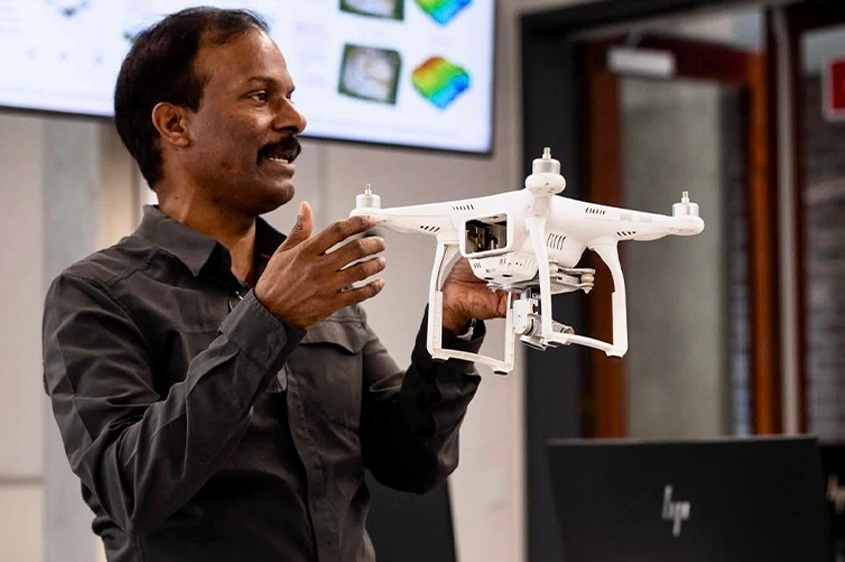 A key objective of the project is to develop the new
 Applications of Drone and Data Technologies
course.
"This is transformative teaching – it shifts students from passive recipients of knowledge to active investigators, and that is exactly the kind of education that produces graduates who contribute meaningfully to conservation, agriculture, and environmental management in Mpumalanga and beyond."
A key objective of the project is to develop the new Applications of Drone and Data Technologies course while embedding drone data analysis and geographic information systems (GIS) across existing programmes. Rather than being taught as a standalone technical subject, these technologies will become part of how students study disciplines such as soil science, agriculture, archaeology, wildlife and environmental science.
Professor Parker said the project adopts a curriculum infusion model across multiple disciplines, supported by open-access web tools and practical laboratory activities using real Mpumalanga datasets.
"For students, this means encountering geospatial methods in a context that is directly relevant to their field of study. Alongside this, we are discussing a Short Learning Programme that will make these skills available to working professionals in government, conservation, and agriculture – a direct contribution to the regional workforce."
Building Geospatial Capacity Through Mentorship and Innovation
During his recent visit to UMP, Professor Muthukrishnan conducted one-on-one mentoring sessions with postgraduate students whose research focused on locally relevant challenges, including soil erosion, vegetation changes around human settlements and the mapping of vulnerable heritage sites.
Reflecting on his engagement with UMP academics, he said:
"I was struck by the willingness to engage critically with their own teaching – to sit down and honestly ask, what are my students not getting from the way I currently teach this? That kind of intellectual humility is the foundation of genuine curriculum transformation."
The collaboration has also resulted in the development of several web-based geospatial tools by Professor Muthukrishnan and UMP students. These include the Mpumalanga Census Explorer, Crop Health Monitoring Tool, Soil Erosion Calculator and South Africa Soil Explorer. Built using provincial datasets and calibrated to South African conditions, the tools are designed for use by students in Soil Science, Development Studies, Agriculture and Environmental Science without requiring specialised software.
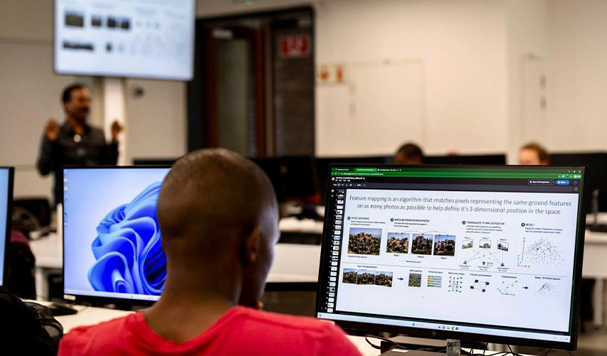 The collaboration has also resulted in the development of several web-based geospatial tools by Professor Muthukrishnan and UMP students.
Professor Muthukrishnan encouraged students to combine their understanding of local communities with technical expertise, saying, "The world needs you – specifically you, with your knowledge of this landscape, these communities and their culture, and these challenges – far more than it needs another analyst sitting far away and theorising about southern Africa from a distance."
He added: "The tools are increasingly accessible, and many are free. The data exists. What is needed is the training, the curiosity, and the determination to develop genuine expertise – and then to apply it where it counts. Secondly, think globally about your career from the start.
The international community is interested in what is happening here and wants to collaborate with the next generation of Southern African scholars. Position yourself to be part of that conversation. Learn the tools, build your networks, and do not underestimate what you bring to the table."
Supporting Vision 2030
Professor Parker said the initiative advances UMP's Vision 2030 by providing innovative educational opportunities through strategic international partnerships while addressing regional development priorities.
"This initiative delivers a curriculum infusion model that puts cutting-edge tools in the hands of students across conservation science, environmental science, agriculture, soil and crop sciences, archaeology and development studies," he added.
"The proposed Short Learning Programme will strengthen the skills of professionals in government and conservation agencies. The planned COIL partnership with Furman University gives our students a virtual window into a different academic and professional world. The ongoing SANBI research collaboration and high-resolution LiDAR study of archaeological sites in northern Kruger positions UMP as an active contributor to national knowledge. This is precisely what a young, engaged university with a regional development mandate should be doing," explained Professor Parker.
Story by Cleopatra Makhaga. Pictures supplied. Copyright © UMP.